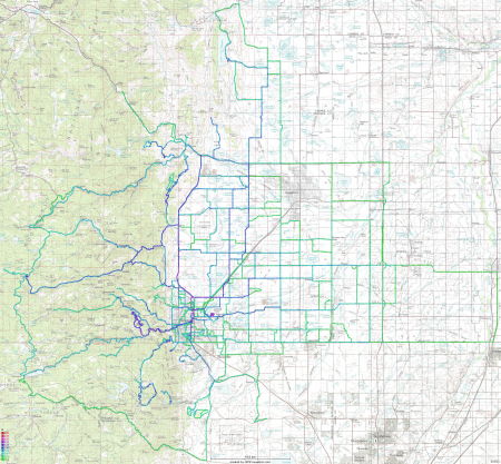
Below is a kernel-density map showing where and how often I've ridden my bike around Boulder in the last year and a half. I've posted things like this before for my rides in California. The color map (the legend is in the bottom-left corner) indicates that anywhere there's a green dot, I've cycled through there at most a few times, and anything between blue and purple are my usual routes. There are a few red points mainly centered around where I live, which corresponds to places I've been through a few hundreds of times.
Looking at the map, I'm a bit surprised at the amount of exploring I've done out in the plains. I didn't realize I had done that much out there. I also want to note that most of the dead-end segments are due to geography - the roads end where the segments do.
