What Earning a PhD Does to Physical Activity
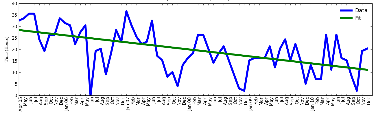
Above is a plot showing how many hours I have logged on my Garmin GPS devices since I got my first one in April 2005. This is mostly cycling, but also walking, running and some hiking. However, this is not a true measure of my physical activity over this period because it is missing data. Up to late 2007, I was active on the velodrome, and I didn't bother using my GPS there. In the last year, I've tried to walk to school more often, and for the most part I haven't used my Garmin on those walks. But it does capture the majority of my physical activity, which is road and mountain biking, where I always use a GPS.
In green I've over-plotted a linear fit to the data. I have chosen a linear fit as it shows the overall trend in the clearest way possible. For some reason, June 2006 shows zero hours, which I believe to be wrong. I can't believe I did nothing at all during any summer month in 2006. Therefore, for purposes of the fit, I have given that month the average hours of the four bracketing months.
Even knowing that lots of data is missing from both the front- and back-ends of the figure, it is still clear what the overall trend was. Down - down significantly from nearly 30 hours a month five years ago to just above 10. There of course is a great variability from month to month, but the fit shows clearly the overall trend of what trying to finish graduate school does to physical activity.
I find the lack of patterns interesting. Some years, I really struggled to stay active during the late fall, which makes a certain amount of sense when weather and schoolwork is factored in. However, other years it apparently didn't affect me at all. The bounce in hours since October 2010 makes sense because that's when I graduated, but the two months in 2010 with 25+ hours is confusing. I can't remember how I achieved that!
Nerd time: I made the figure in Python using matplotlib and numpy. Excel is for suckers!
more ...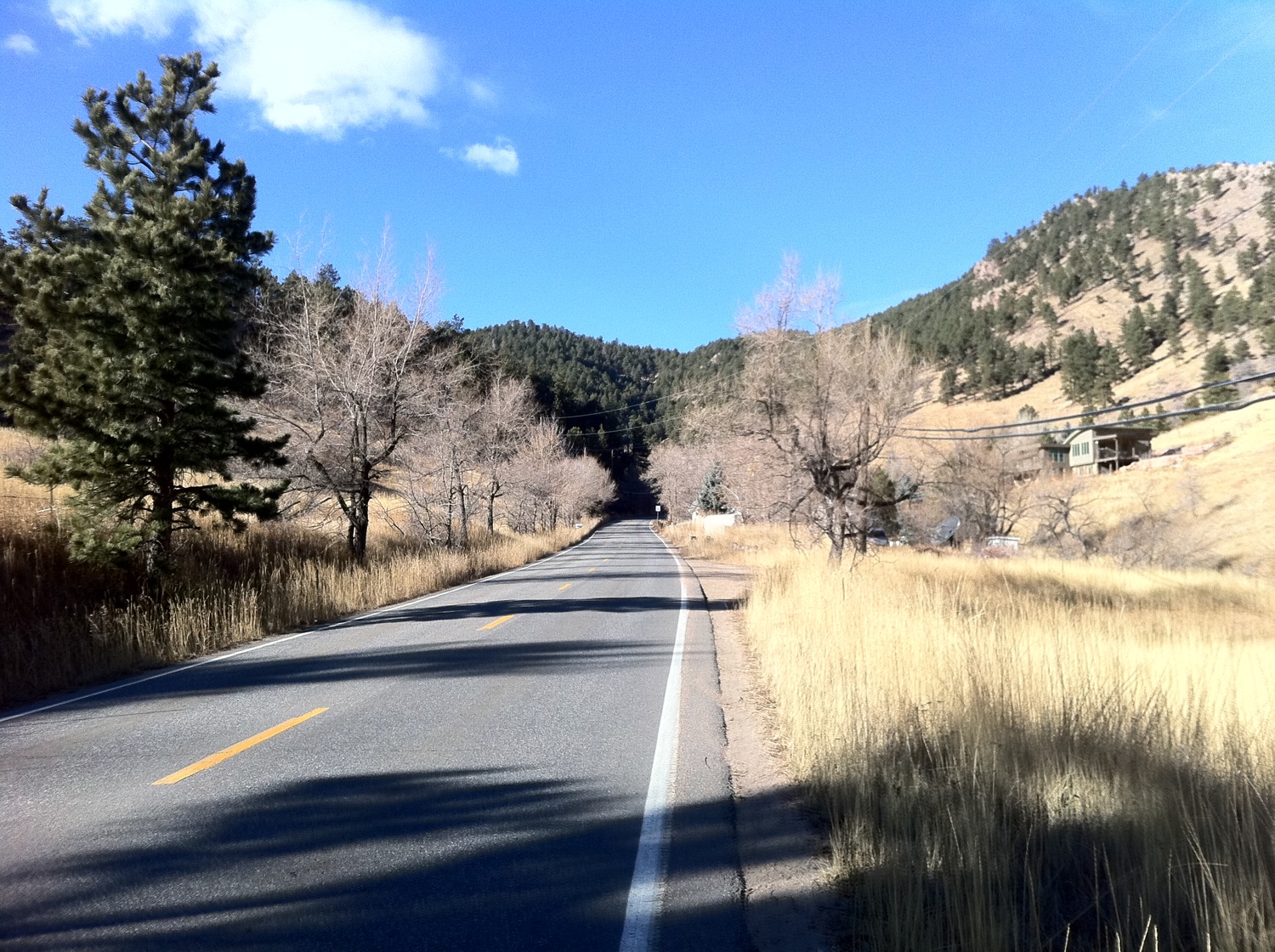
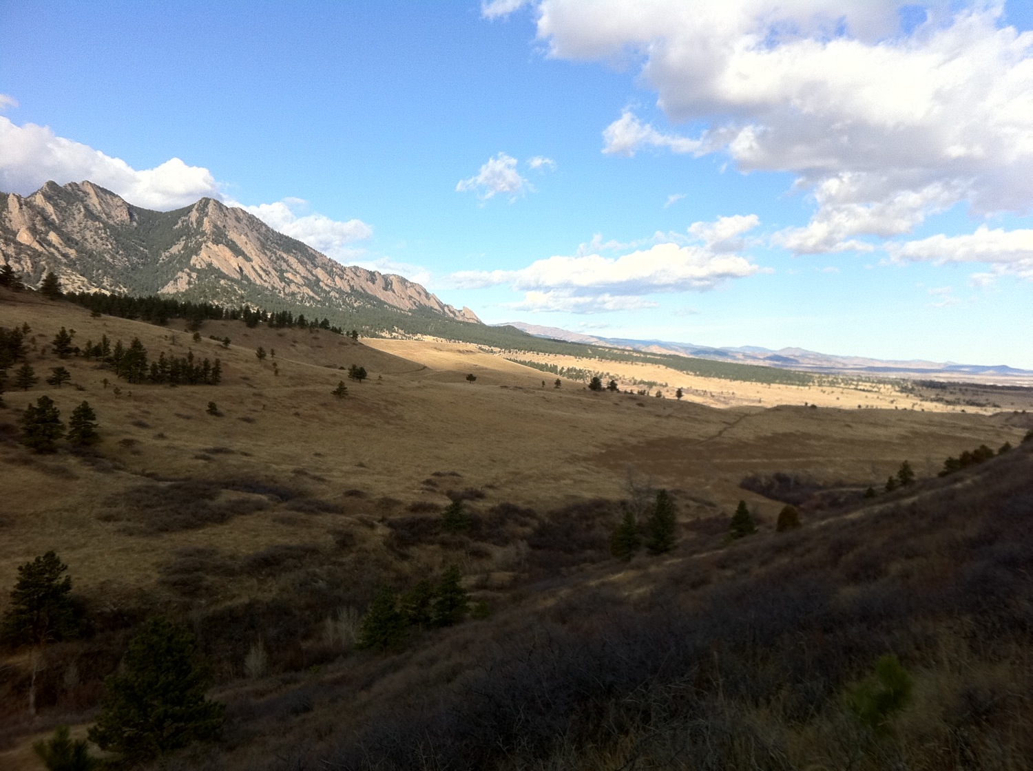
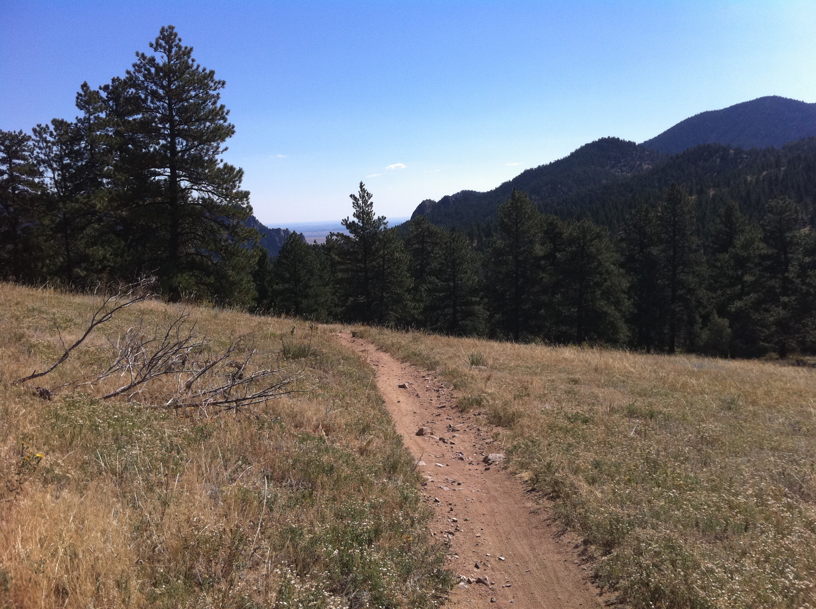
Flatirons Vista
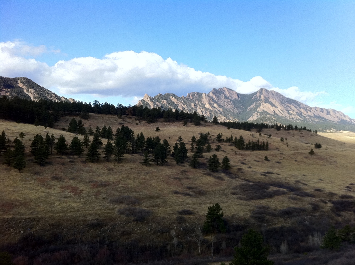
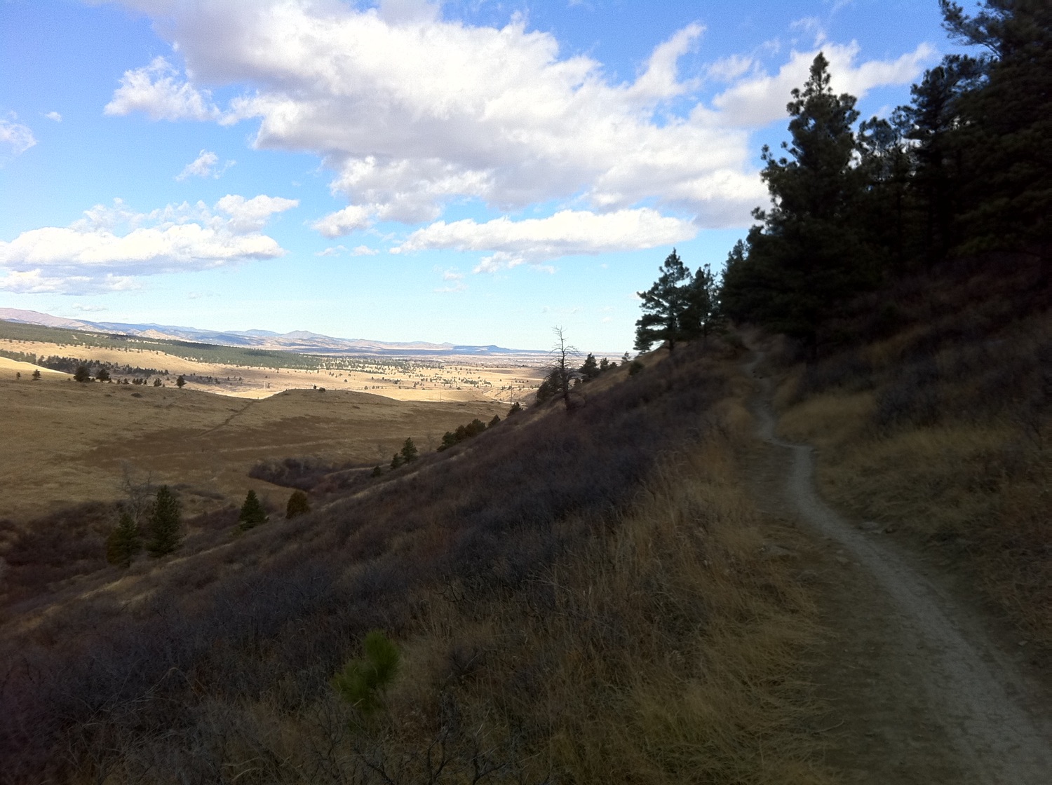
Here are some pictures I took on my mountain bike ride on Thursday, two days ago, from the Flatirons Vista Trails south of Boulder. The trails are decent single track that is just a bit more bumpy than I like (this kind of bumpy is not the same as technical, it's just annoying). If I had a full-suspension bike I would probably not find the bumpiness so grating. Indeed, most of the riders I saw on the trails had a full-suspension bike.
The weather lately has been dry and mild, as the photos show. The autumn precipitation so far in Boulder is well below seasonal averages. In contrast, apparently the high mountains have been dumped with snow all fall. I guess I brought some San Diego with me to Boulder.
 more ...
Back in The Saddle Again
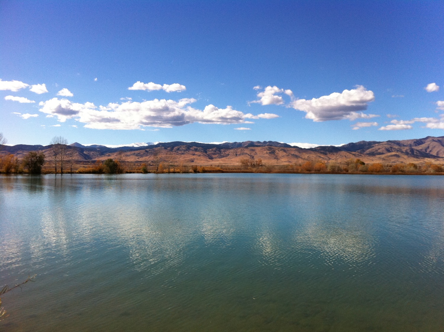
Today was my first official day of my postdoc position. Naturally, like most people would, I skipped out early to go ride my bike. It makes more sense once you know that for the last month and a half, I haven't gone for a bike ride because I haven't had health insurance. Not being insured made bike riding a risky proposition. As a result, I've also been walking to school and back which takes 40+ minutes each way, in comparison to the 10 minutes it takes on a bike. Today was my first opportunity to ride my bike, and it was sunny and relatively warm, so I wasn't going to pass it up. In addition, I've basically been doing this job for over a month already, so the first-day impression came long ago.
Today's ride was a bit of exploration, and very autumnal, as the photo above proves. If you look carefully, you can see some snow on the highest peaks. It was also my first opportunity to use my new Garmin Edge 705, which was a graduation present from various Ruggles. My legs definitely exhibited the effects of no bike riding -; they got tired very quickly.
Finally, happy November!
more ...More Bragging
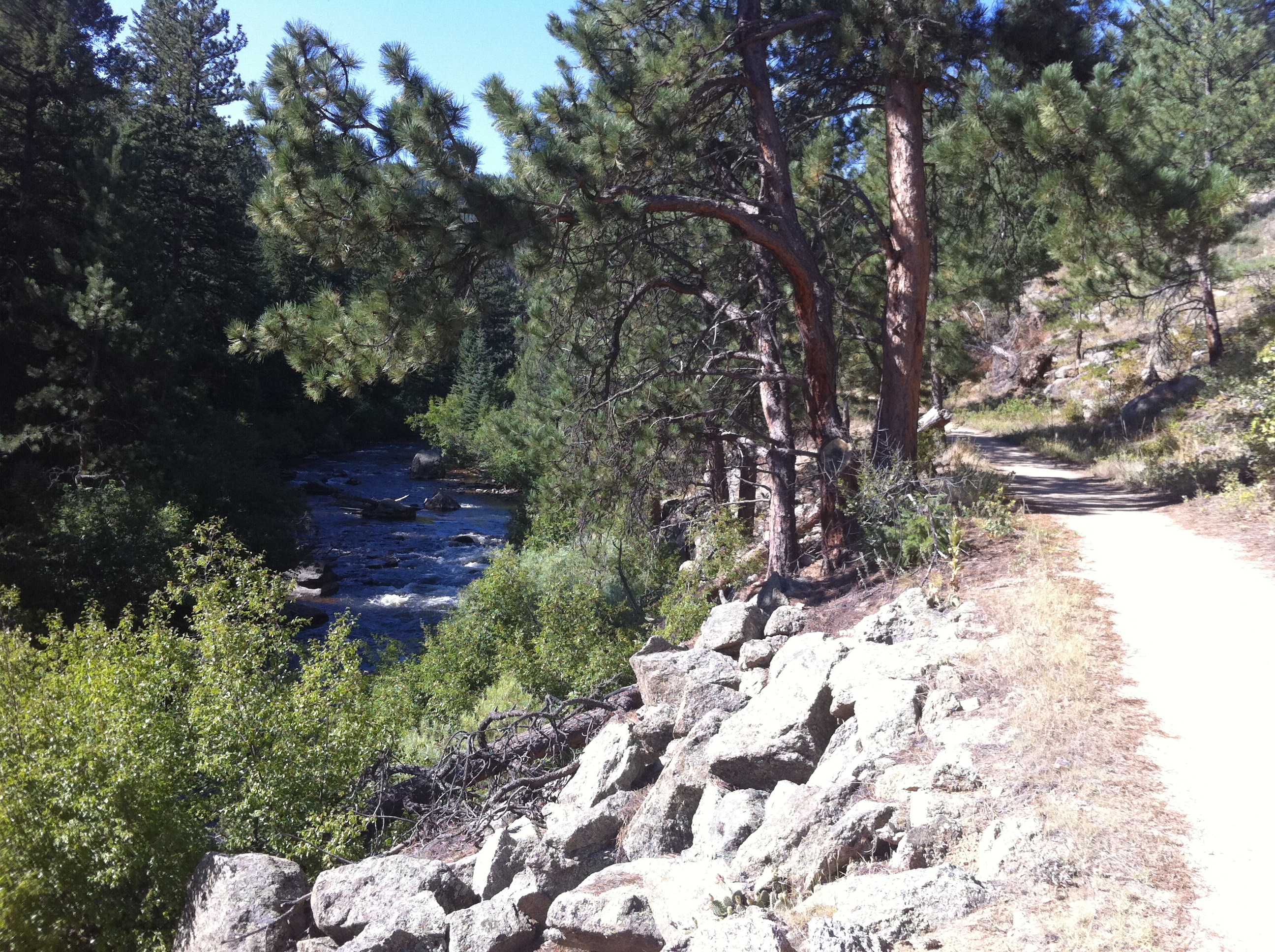
Today I rode "Super Walker" which means that I did the Walker Ranch loop starting from town rather than the trail head. It turns out that the ride really is super, and there is a huge amount of climbing. Over 5000 feet of climbing in 30 miles.
I am going to brag again about how amazing cycling is here, and show some more photos of some of the ride today. You may click on them to enlarge them. Below is South Boulder Creek, which a couple parts of the loop crosses and parallels. The water was moving at a good clip!
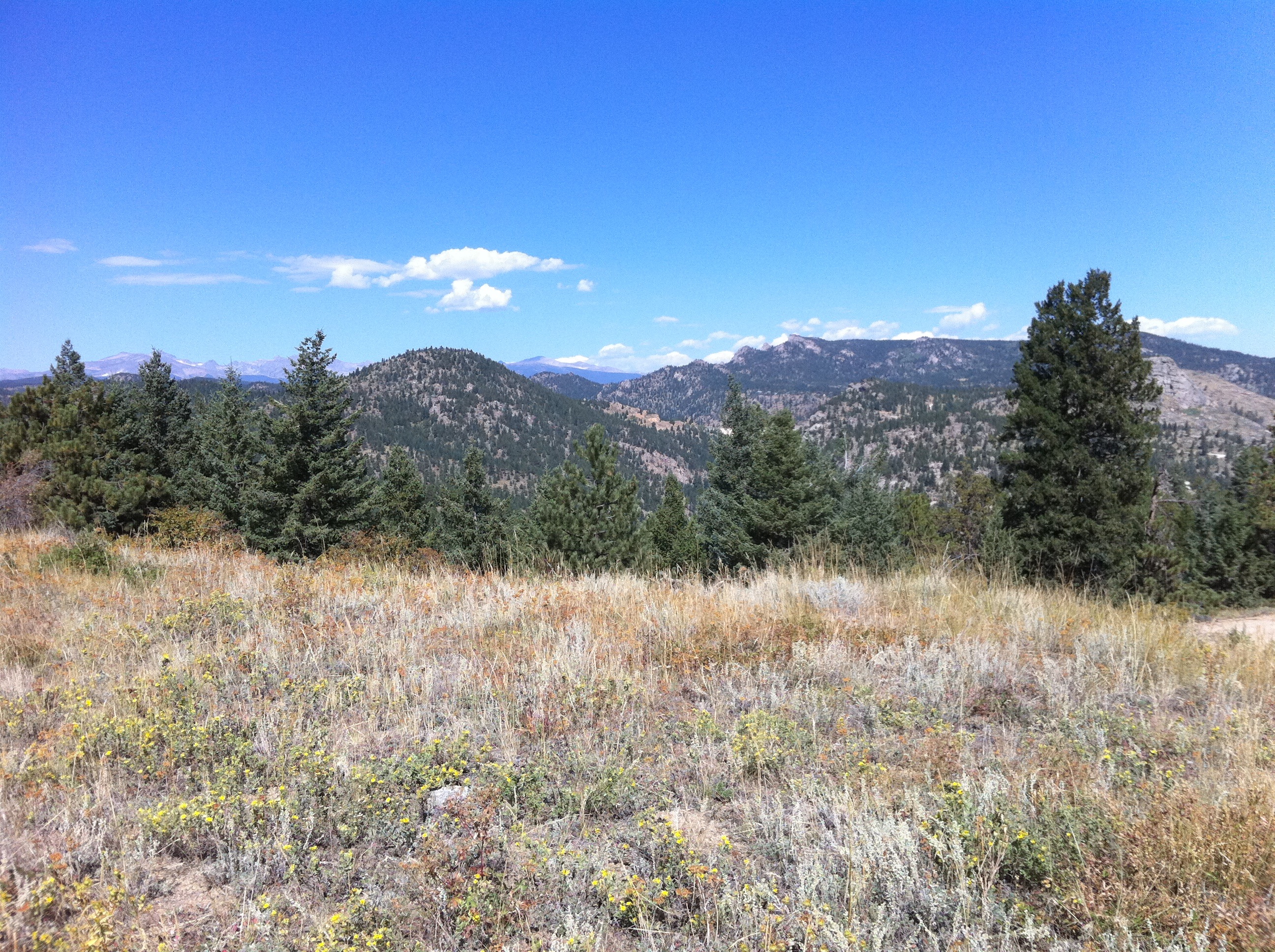
A view looking North-West from one of the ridge lines the trail follows.
This is looking roughly East, down into the plains South of Boulder in front of the mountains.
Often times, the warning signs along trails are overly-cautious. It's not that I think they don't apply to me, but once I've ridden a trail a few times, I can judge for myself how technical the trail is, or how fast to take a corner. As long as there is no one else on the trail, and I can see far enough forward to be safe, I go my own speed. On this trail, however, I do not have experience, so I decided to heed the warning.
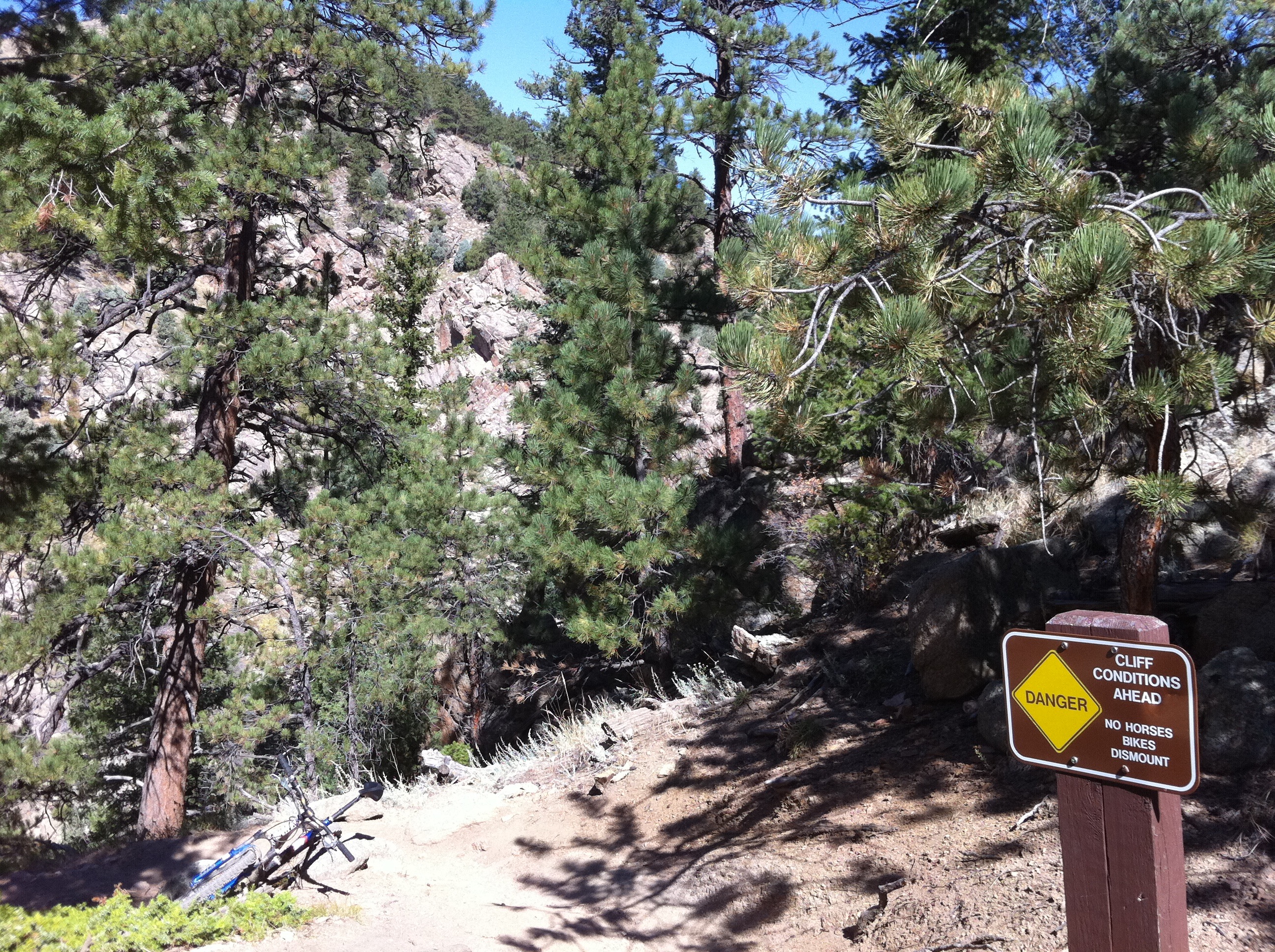
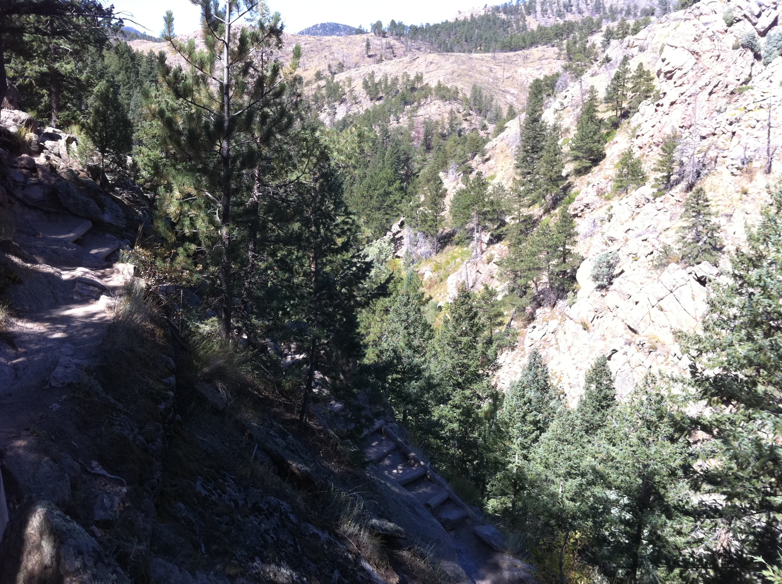
This is one case where the warning sign is correct. These are the stairs immediately after the sign that are significantly steeper, with bigger vertical step sizes, than most people find comfortable. It's always tough to tell how steep things are in photos, but trust me, there is no chance I'll ever ride these stairs. The stairs go down to the canyon floor which has been carved by South Boulder Creek, and is very steep and rocky (as can be seen) on both sides. But the scenery is fantastic, so the inconvenience of the stairs is worth it!
Busy Times in Colorado
It has been nearly a month a half since my last post about leaving San Diego, and we've finally made it to Boulder! Ok, actually it didn't take that long. It took us two days, with a stop overnight in Saint George, Utah. The long gap in posting is due to how busy I've been here in Boulder, which has been nearly entirely due to getting my thesis done, but also to a good deal of work getting the new apartment put together. Those things deserve their own posts, which may or may not happen.
What I would like to post here are some pictures I took on my bike ride yesterday. I am 99.7% done with the draft of my thesis which I'm sending to my advisors this weekend, so I figured I could take some time to ride my bike recreationally. This is a novelty for me recently. Come wintertime, I'm definitely going to miss the weather in San Diego, but right now, cycling here definitely beats San Diego. It takes less than ten minutes to get out of town onto roads like this:
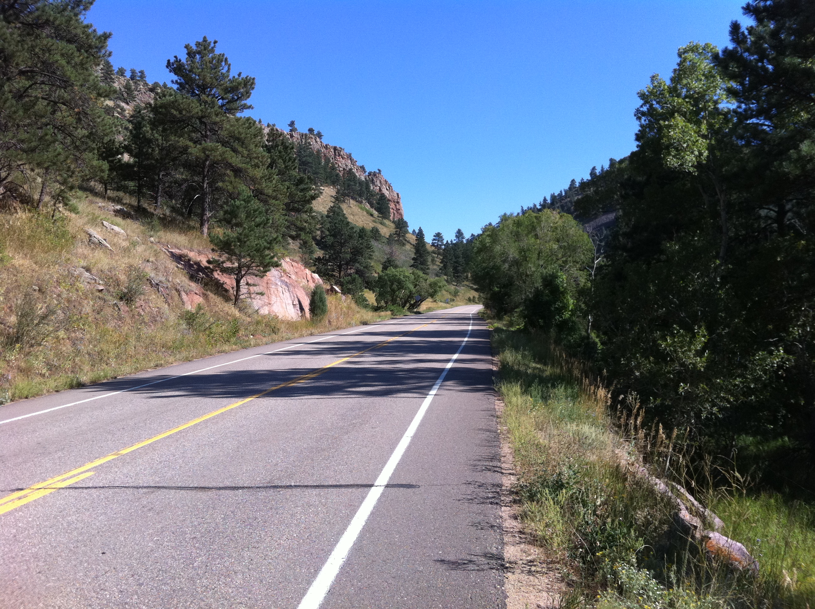
or this:
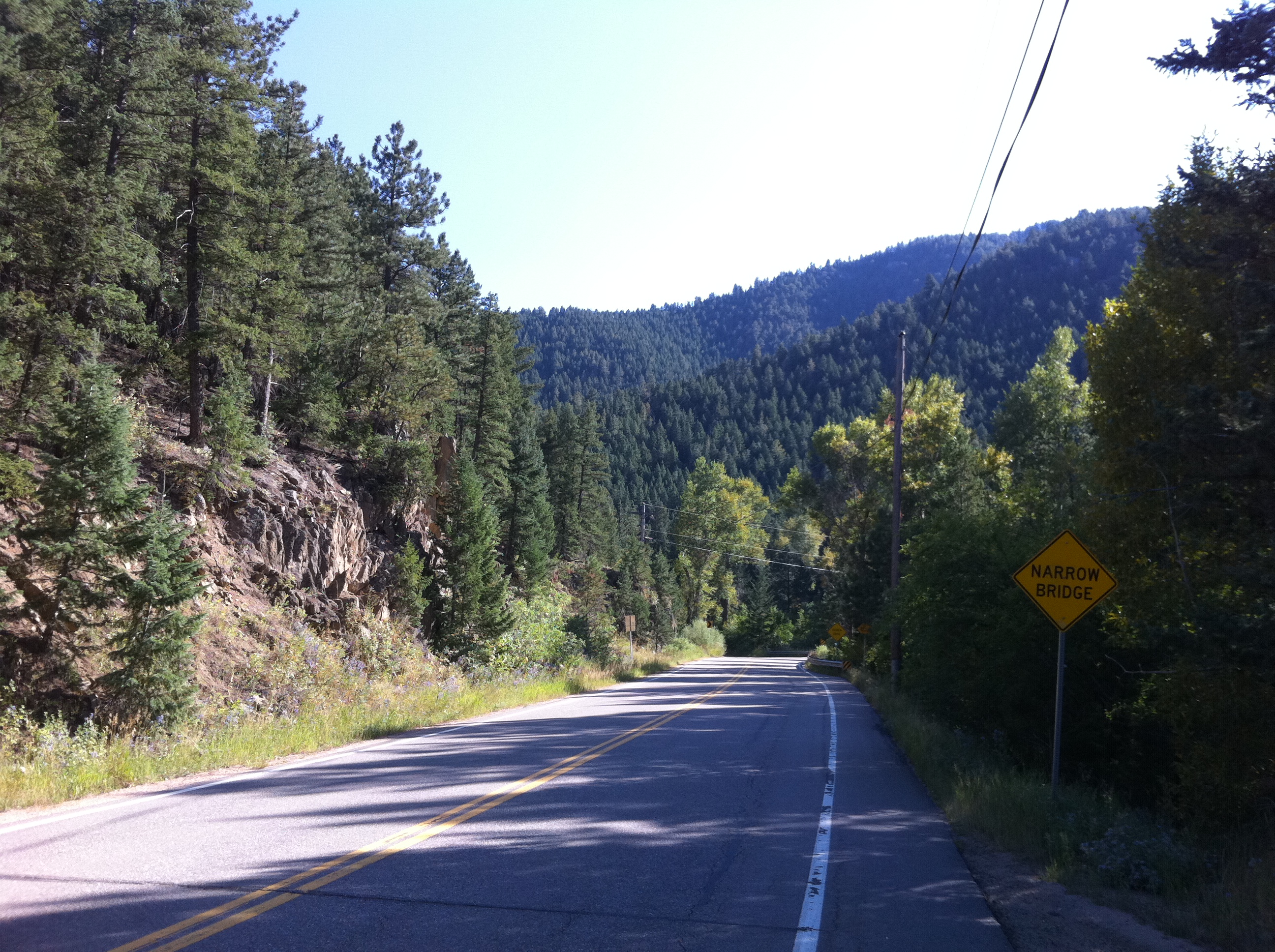
or this where it feels like I can see all the way to Kansas over the plains:
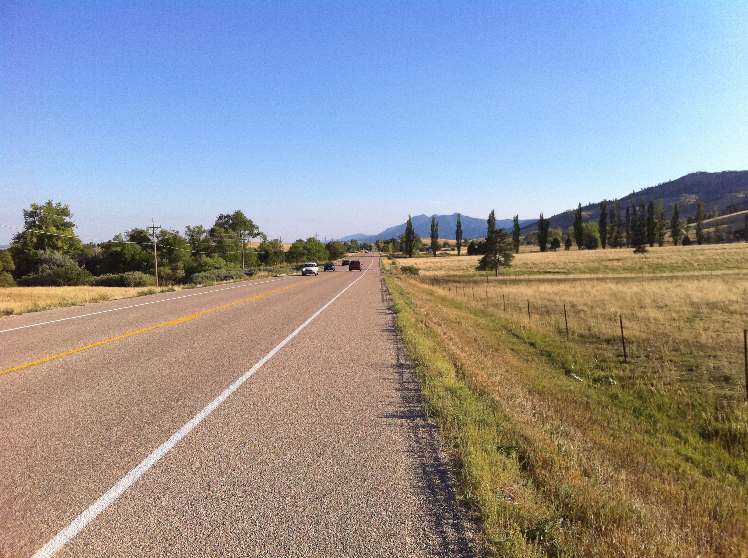
I just wanted to share. Hopefully, now that the bulk of the thesis is done, I can enjoy this area a bit before winter hits!
more ...Tour Pool 2010
![]()
I've posted the 2010 Tour Pool results page. I did absolutely no research for my team, and I'll probably do just as well as all the other years I've participated. I have a few more sprinters than normal this time, so hopefully I'll get some more bonus time than what I usually get, which is very little.
For this year I bought a pass so I can watch the Tour online, live or time shifted after the daily stage is over, for something like $30. I feel that this is entirely appropriate because it jibes with my issues with subscription television. There are several channels on Cable/Satellite that I would like to have (Comedy Central, old SciFi (not the SyFy it has turned into), Versus, Discovery...), but the large majority I can do without. The media companies make it impossible to pick and choose the channels in an a-la-carte fashion, so I choose to have no subscription TV at all. Paying for this specific event just once, rather than month over month, allows me to view what I want, where I want, and it saves me money.
Oh, and I think Contador will win this year, and Lance will be top five.
more ...A Dream Realized
Last Thanksgiving I attempted to do a ride I have had in mind for a long time. There are four regional parks near to me, Peñasquitos, Sycamore Canyon, Mission Trails, and Marion Bear, that I have mountain biked in over the last few years. It occurred to me some time ago that I could make a loop of them and ride all four in one day. My attempt in November was unsuccessful - my route through Mission Trails was ill-chosen and it nearly killed me (OK, not really, but it was pretty awful). I decided to go directly home, skipping Marion Bear, and finished with only three of the four.
Today I, and my friend Stephen, accomplished the four-park ride. Most of the time and distance was off-road, although there is the inevitable on-road connecting sections. There were no crashes, although I nearly endoed at one point, and one pedal broke (his). Luckily it wasn't too hot out in Sycamore Canyon. I'm tired, of course, but happy that I finally accomplished it.
more ...Kilometers and Memories
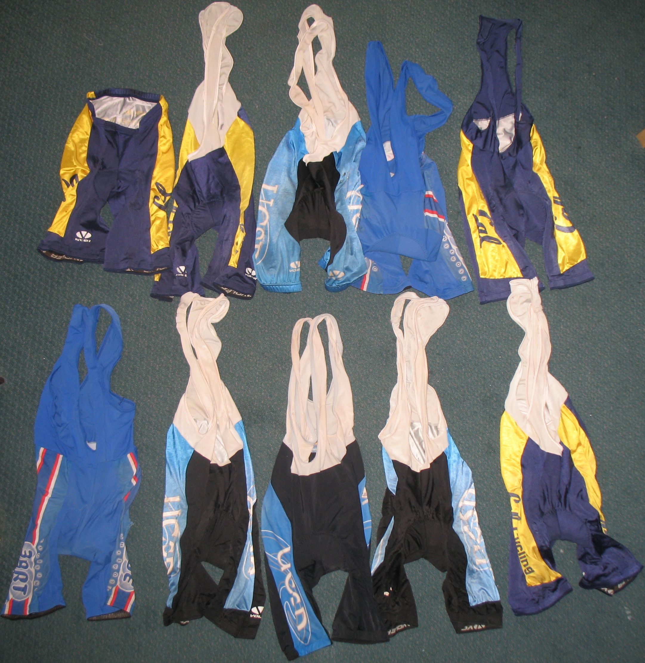
Above are my cycling shorts that are too old, too thin, too ripped and too transparent to wear anymore. For precisely the same reason I should get rid of them, I want to keep them. I have ridden many kilometers wearing these shorts (at least 30,000 kilometers worth in this photo, likely much more) and made lots of memories. All of my Cal Cycling shorts, and most of my UCSD Cycling shorts are worn out. But they are taking up space, and I can't imagine wearing them ever again. I intend on eventually purchasing new kits from my former cycling teams to replace these, but it won't be the same. I am in mourning.
more ...25 Hours of Frog Hollow
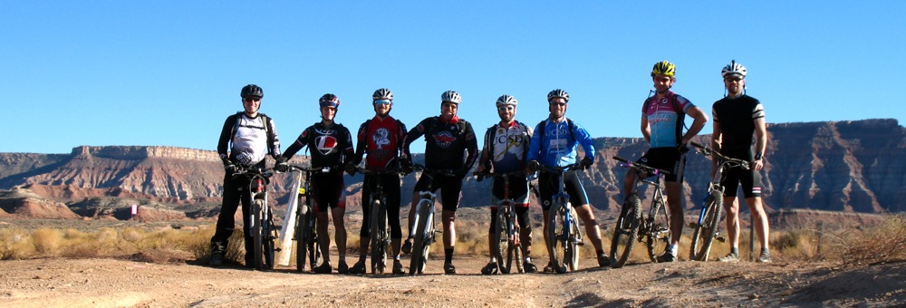
Last week I traveled to Utah with seven friends (above: Paul, Chris, Stephen L, Mike M, Mark, Mike H, Matt and me) to ride our mountain bikes. The main attraction was the 25 Hours of Frog Hollow race that was held 10 A.M. October 31 to 10 A.M. November 1. The twenty-fifth hour was provided by the end of daylight savings time that happened during the race.
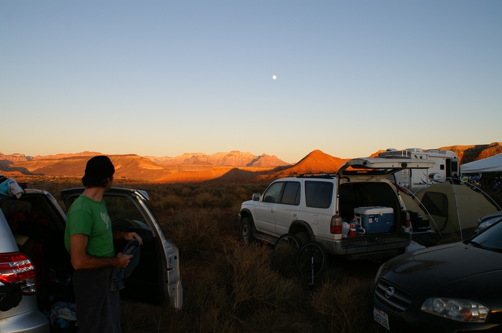
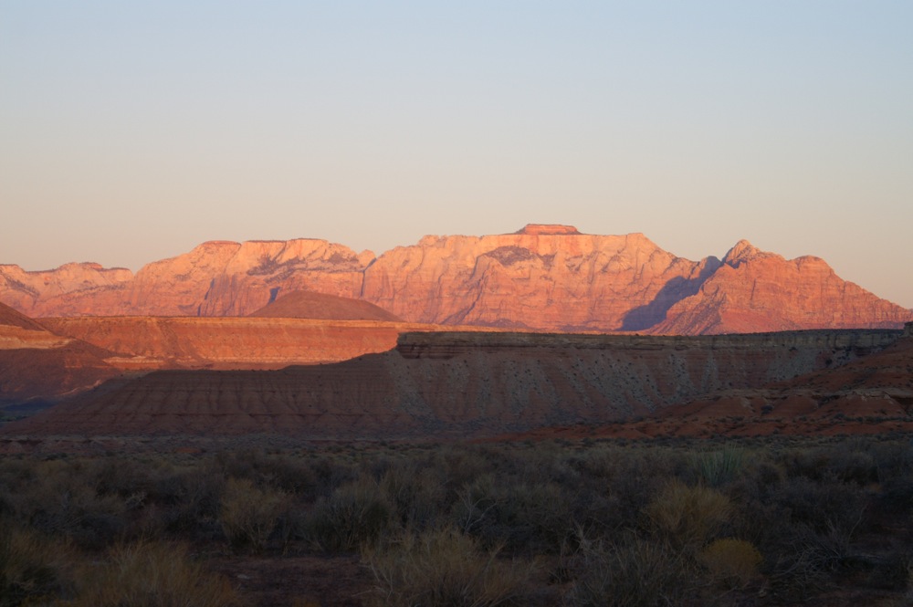
The race was held just outside the sleepy Utah towns of Hurricane and La Verkin, near St. George. The location is amazing, which I'm told is not unusual for Utah. Above you can see Matt watching the sunset on the mountains and the (nearly full) moonrise as he gets ready for a lap.
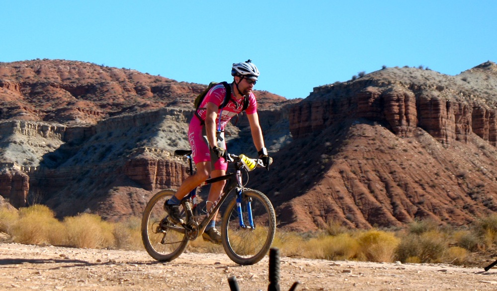
The course itself is broken up into four sections. It starts out with a climb, mostly on fire roads. Next is a descent on the Gem Trail which is fast and smooth and extremely enjoyable. After the Gem trail, there is a section on flat fire road that connects to the Virgin River Rim trail (I think that's the name) which is a very brutal and demoralizing stretch of rocky single track. The trail is littered with sharp-edged flat-topped rocks spaced inches to feet apart. It was difficult to maintain momentum and the terrain made my back hurt.
I rode four laps of the course. My first at 11 am, then 3pm, 8pm and finally at 3am. The pace of laps naturally slowed at night, and we also got some sleep in the early part of the morning. The bright moon meant I didn't need my lights for most of the climb on the night laps. This kept my eyes sensitive, and I could see the sky filled with stars. On one of the night laps I stopped for a minute or two to just enjoy the calm and emptiness of the desert at night. The weather was very amenable to racing. It was clear the whole race with minimal winds. The daytime had temperatures in the mid-70s (F, of course), and nighttime in the low 40s. For the very curious, I have the GPS track of my ride online. I didn't clear the GPS between laps so there are some weird smoothing effects on the graphs during the time I turned off the GPS.
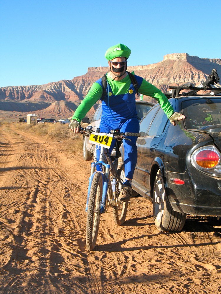
My team was made up of Matt, Chris and Stephen L, and we came in fifth of six finishing teams, out of seven that started the four-person category. The other team in our group, Paul, Mike M, Mark and Mike H, finished one lap up on us and in fourth place. Neither of our teams had any designs on actually competing for a high place in the event, so we are both satisfied with the results. All of us also had Halloween costumes. Mike H above shows his very warm Luigi costume that came in handy for one of his night laps.
I want to also mention the ride we did a few days before the race, on Gooseberry Mesa. This was riding like I have never done before. The mesa has huge rock-face sections that we crossed on which the trail is marked by painted white dots. It felt like sight-reading music for the first time, picking our way on carefully planned routes to cross technical rock sections. The trail network is built on a mesa that narrows to a point high above the surrounding land. The land below is the area on which the race was held, and a few of the fire road sections can be seen.

A couple of the trails we rode tracked the rims of the mesa very closely, especially the south rim trail. In this Google Earth image, you can see just how closely the red line tracks the edge of the mesa, and below you can see the sharpness of the mesa edge near the point. It was truly spectacular riding!For the very curious, here is the GPS track for that ride.
2009 Tour Pool Wrap-Up
The 2009 Tour de France pool is over, and Team Storky came in fifth. In terms of the time gap to the winner, this team did better than any I've been part of before. But it lacked several things: luck and winners.
The team lost Levi Leipheimer, a nearly-guaranteed top-five finisher, Jens Voigt who always finishes tours well-placed and is capable of winning a stage, and Robert Gesink, a promising young Dutch rider who has won a Tour of California stage ahead of Leipheimer and finished seventh in the 2008 Vuelta a España. No other team in the pool lost a single rider of the caliber of Leipheimer, nor three riders of such skill and ability.
The team also got exactly two time bonuses, for a total of 25 minutes of bonus time. This put Team Storky as the second-lowest team in terms of accumulated bonus time, ahead of only the astoundingly unlucky Team John Arnold. Team Wells got over eight times as much bonus time as Team Storky. On one stage, a group of eight escaped from the pack and reached the finish before everyone else. Of those eight, three were on Team Storky. Time bonuses go to first, second and third. The Team Storky riders got forth, fifth and seventh. That outcome is emblematic of the kind of luck the team had throughout the tour. It appears that to win the pool, a team needs at least a sprinter or two that can finish well-placed on a number of stages reliably, something my team didn't have.
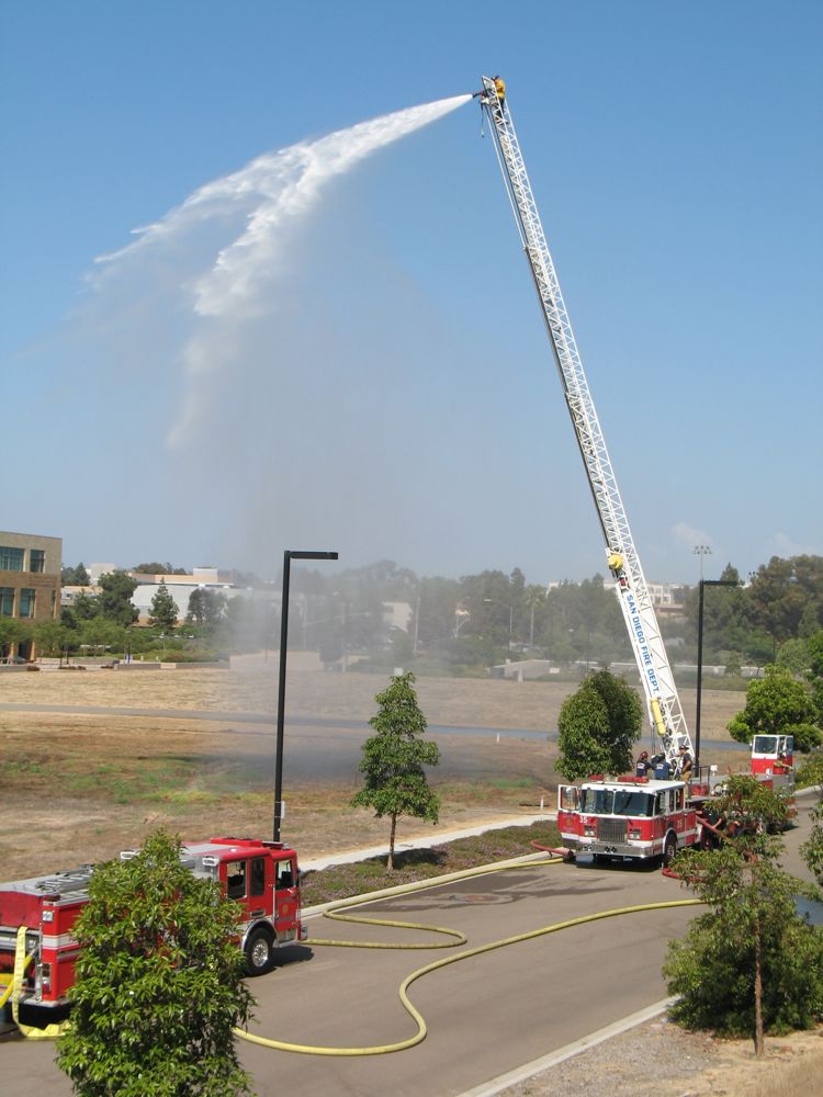
Above: The fire department was training across the street from my apartment on Sunday, in no way related to the Tour de France. I just wanted to share that.
more ...DTV Delivers
Big news.
Universal Sports, which is part of NBC, is going to show the entire Giro d'Italia live! I'm guessing that because Lance is riding the Giro, Universal Sports figures Americans will be interested. Down here in San Diego, the local NBC affiliate broadcasts several digital channels over the airwaves. They have their main channel 39-1, that shows full-1080p high definition TV. They also have 39-2, a weather channel, and 39-3 shows Universal Sports. Neither is HDTV, but I'm not complaining. The Tour de France is always on cable, so I have to go to a friends apartment to watch it. I'll be glad to watch this on my very own couch.
My mornings suddenly got much earlier for the next month.
Update May 9: The Giro is being streamed live online, not over the air. It is just a commercial-free stream of the Italian coverage (with inconsistent English commentary) on the Universal Sports website. I guess I read what I wanted to read. I'll take it however I get it.
more ...My Eddington Number is 48
A couple days ago I was browsing the internet on astrophysical topics, when I came across Sir Arthur Stanley Eddington's wikipedia page. He's best known for the Eddington limit, which describes the luminosity limit of a star as a function of its mass. Near the bottom of his page linked above, there is a description of the "Eddington number," which for any person is the greatest number of bike rides they done which have been that at least that number in miles long. From the wikipedia page:
The Eddington Number in this context is defined as E, the number of days a cyclist has cycled more than E miles. For example an Eddington Number of 70 would imply that a cyclist has cycled more than 70 miles in a day on 70 occasions.
This is very similar to the Erdős number and the h-index, which measure a scientists publishing impact. I don't have an Erdős number, nor an h-index, but I do have an Eddington number. And since I have a nice GPS database of my rides, I figured I could easily calculate it.
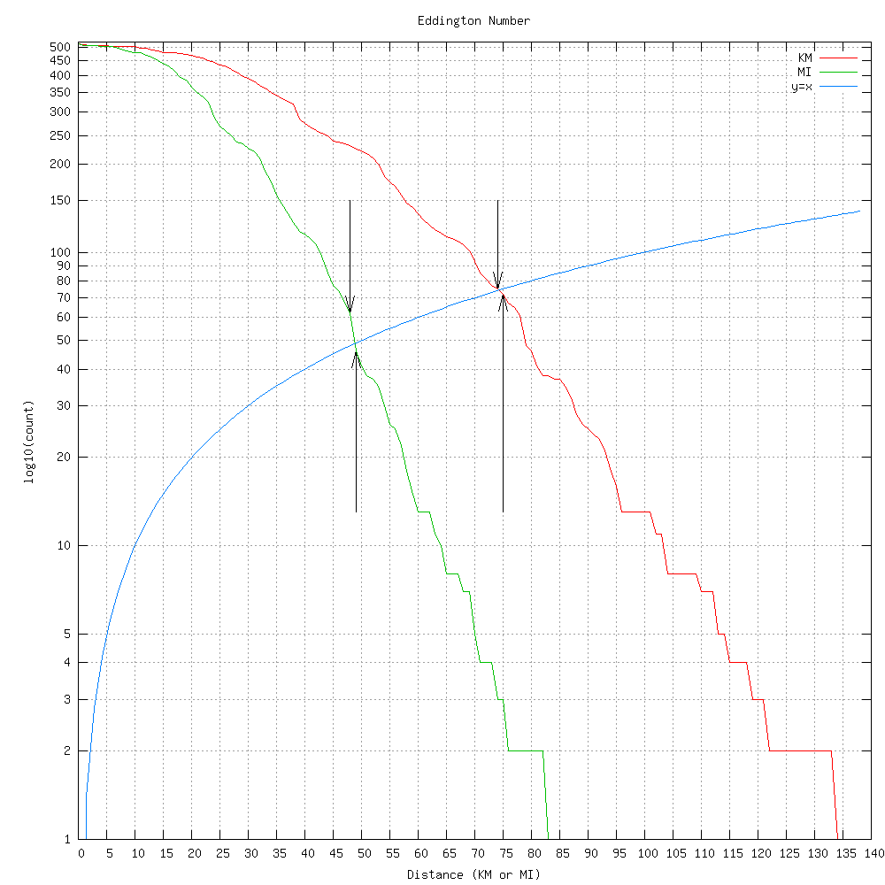
Above shows two Eddington calculations, in miles and in kilometers. The curved blue line is x=y, and it's curved because the y axis is using a logscale. Where the blue line intersects the Eddington lines is my Eddington number. The downward arrows show my actual integer Eddington numbers (48 for miles, 74 for kilometers), while the upward arrows show that 49 and 75 aren't above the blue line, and thus aren't my Eddington numbers. Since the definition is in miles, my true number is 48, but the kilometer calculation shows that the number is also a function of your unit.
Unfortunately, I don't have records before I got my GPS, so my true Eddington number is surely larger.
more ...No More Tunnels
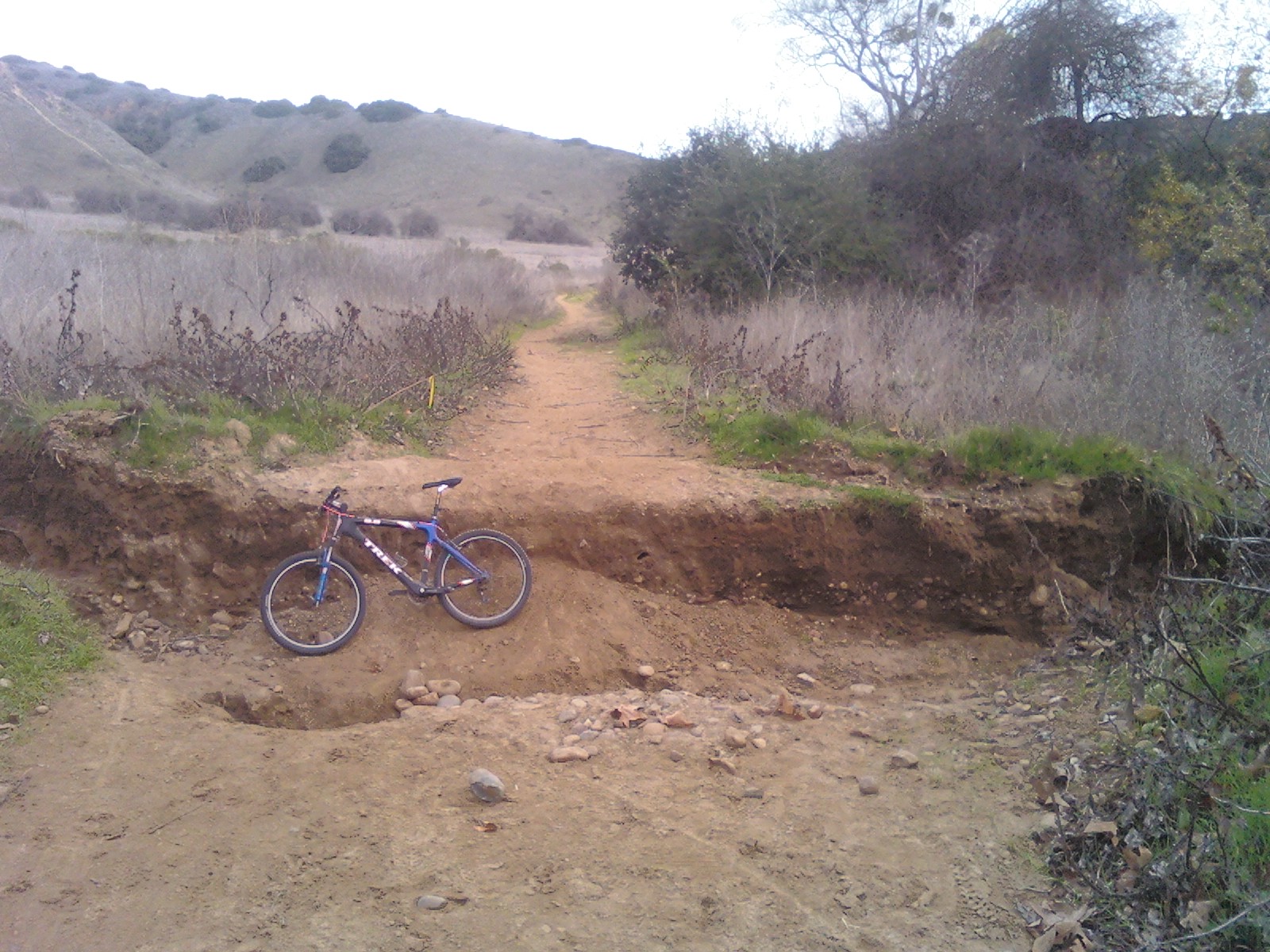
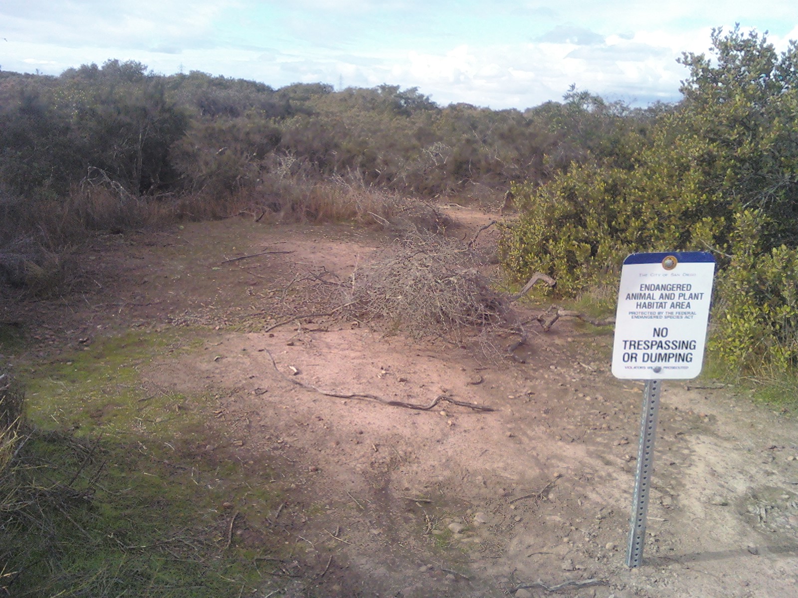
By far my favorite place to ride my mountain bike (that is reachable without driving) are the single track "tunnels" that are typically reached through Peñasquitos Park (although they aren't actually inside the park, they are on non-park city land). They are called "the tunnels" because for most of their length they are covered by low bushes and trees just over head height. There are four of them that total a few miles in length and vary in technical difficulty. Until about a month ago, they were somewhat illicit and not patrolled, now they are very expressly illegal. During the rainy season I think it's perfectly reasonable to close them. Muddy and wet ground is especially susceptible to erosion, and nature doesn't need human help to erode the ground during the rainy season. The ditch my bike is pictured in above was fairly level ground the last time I was there, less than a month ago (*).
Unfortunately, there is strong evidence that the City of San Diego is planning on closing them permanently, or at least severely curtailing how many can be used. Since the tunnels are fairly far from any road, it's only cyclists that use them with regularity, but the city feels it needs to consider all the other potential users. Cyclists are the lowest on the public land user totem pole, so you can see how this can do nothing but hurt our interests. I suspect that if they're kept open, they'll have to be upgraded so hikers and equestrians can use them, which will remove much of what is attractive about them (which is the lack of those two groups for a large part). If they're closed for environmental reasons, only cyclists will miss them. It's kind of a lose-lose situation for us.
The City of San Diego isn't full of complete idiots, there is a series of legal drag race events that take place in the Qualcomm parking lot. This alleviates the pressure of what many people want to do and would resort to doing illegally without other options. There is a similar pressure from cyclists who want quality single track trails. If trails are available, legal and fun, cyclists won't have to resort to cutting trails and breaking laws. We'll see if the city has enough foresight to recognize this.
(*) For those my friends to are familiar with Peñasquitos, if you're heading east, this is just past the big deep sandy patch where you used to have to ride on the extreme right, and just before the really rocky climb. I think it's in the center of here. The second photo above is the top of the third tunnel, the farthest north of the three linked tunnels. The riding I did do today (I didn't go into the tunnels) showed that many of the lines we rode in the summer are now completely different.
more ...